Official websites use .gov
A .gov website belongs to an official government organization in the United States.

Secure .gov websites use HTTPS
A lock ( ) or https:// means you’ve safely connected to the .gov website. Share sensitive information only on official, secure websites.

Tracking long-term change along the U.S.’s major coastlines

Ocean Acidification Research Cruises

Our cruises bring together ocean acidification researchers from across the region to supply coastwide climate-quality information on ocean conditions.

Recent Federal Funding Opportunity

Ocean Acidification Coastal Research Cruise

Uniting Investigations
and Shipboard Experiments

Our Coastal Ocean Acidification Research Cruises

We support ocean acidification research cruises to provide climate-quality information on ocean conditions.

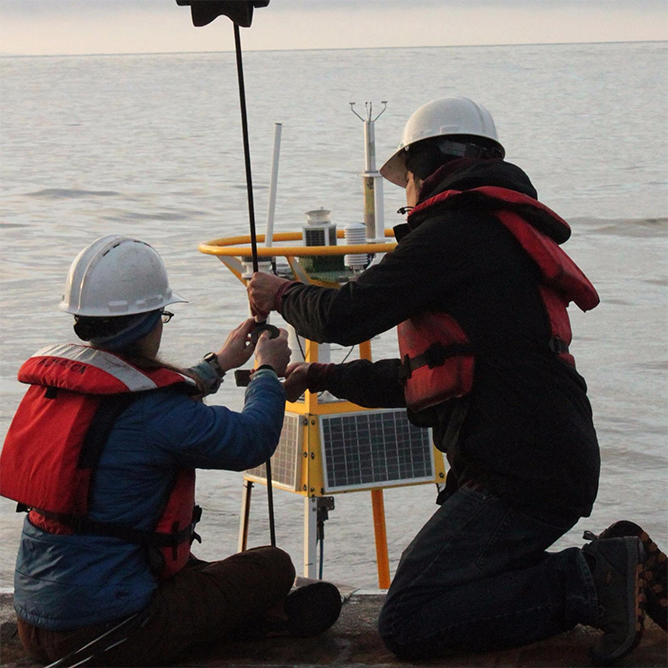
NOAA’s Ocean Acidification Program supports coastal and ocean acidification research cruises along the U.S.’s major coastlines. These essential cruises supply coastwide climate-quality information on ocean conditions. More recent cruises collect and connect biology and ecology to the biogeochemistry of these marine ecosystems.

The information from these research cruises, which generally occur on a 4-year cycle for each coastline, help us track long-term ocean change and evaluate our monitoring network of buoys, gliders, and other tools. They serve as an anchor for research in the region not only by collecting these data, but by bringing together ocean acidification researchers from across the region and beyond. 

What We're Measuring

Conductivity, Temperature, Depth (CTD)
A Conductivity (salinity), Temperature, Depth (CTD) sensor is a key instrument on ocean acidification research cruises. CTD measurements paint a picture of salinity and temperature from surface to seafloor. Temperature and salinity influence water movement, activity by marine life, and water chemistry throughout the ocean. The CTD is linked with a Niskin bottle rosette (pictured). This collector takes water samples at many depths, providing a snapshot of the whole water column. This expands our sampling below surface waters that are continuously monitored by buoys and moorings in our network. Scientists deploy the CTD rosette at every monitoring station during the cruise.
Water Quality
Partial Pressure of CO2 (pCO2)
The partial pressure of CO2 (pCO2) tells us how much carbon dioxide is in seawater. Sampling on coastal and ocean acidification research cruises expands important time-series of marine carbon dioxide levels. This information helps us understand ocean carbonate chemistry and biological productivity in the region. On ECOA-3, NOAA’s Atlantic Oceanographic and Meteorological Laboratory (AOML) measured pCO2 using an onboard system that continuously takes high-quality measurements during the cruise.
Water Chemistry
Dissolved Inorganic Carbon (DIC)
The partial pressure of CO2 (pCO2) tells us how much carbon dioxide is in seawater. Sampling on ocean acidification research cruises expands an important time-series of marine carbon dioxide levels. This information helps us understand ocean carbonate chemistry and biological productivity in the region. On ECOA-3, NOAA’s Atlantic Oceanographic and Meteorological Laboratory (AOML) measured pCO2 using an underway system that continuously takes high-quality measurements during the cruise.
Water Chemistry
Total Alkalinity & pH (TA, pH)
When the ocean absorbs carbon dioxide, chemical reactions create hydrogen ions that act like free agents, able to react with other components in the seawater. Two ways we track ocean acidification are through pH and total alkalinity (TA). pH is a measure of how many free hydrogen ions are in the seawater. More carbon dioxide in the ocean creates more of these free agents, causing lower pH (more acidic). Alkalinity is the ocean’s buffering system against increasing acidity. Total alkalinity is a measure of the concentration of buffering molecules like carbonate and bicarbonate in the seawater that can neutralize acid. Researchers aboard ocean acidification research cruises measure pH and TA along the seaboard.
Photo credit: Joe Salisbury (UNH)
Water Chemistry
Oxygen (O2)
Oxygen is a core measurement taken on coastal and ocean acidification research cruises. Like animals on land, marine life requires sufficient oxygen to live. Ocean oxygen is considered a co-stressor to ocean acidification. Both low oxygen and acidification increase stress on marine life, and they often occur at the same times and places, creating a greater burden for socio-economically important species. On ECOA-3, researchers from the University of Miami researched more about how ocean biogeochemistry controls oxygen saturation. Oxygen is measured onboard using the Winkler titration method.
Water Chemistry
Harmful Algal Blooms & Other Protists
One emerging objective for the ocean acidification research cruises is better understanding the role of biology and marine life with ocean acidification. Harmful algal blooms (HABs) and other protists and plankton can provide biological indicators of ocean conditions. HABs are often created from high nutrient conditions, supporting blooms of plankton that produce toxins that affect marine life, including fish and shellfish people consume. Scientists from North Carolina State University captured and catalogued these tiny organisms and measure their metabolic activity on the ECOA-3 cruise. 
Ecosystem Health
Sediment
Sediments contribute importantly to biogeochemical cycles and remain understudied. On ECOA-3, scientists from the University of Connecticut, Avery Point collected sediments from the seafloor to better understand carbon exchange between seawater and seafloor with the help of bacteria, plankton and other marine life. This was the first time for these in depth sediment analyses on an ECOA cruise.
Take a deep dive with the sediment corer from ECOA-3 >
Ecosystem Health
Nutrients
Nitrate, nitrite, ammonium, phosphate and silicate are major inorganic nutrients that control primary production and carbon movement in the ocean. Together with the measurements of inorganic carbon, researchers will estimate the effect of riverine input, air-sea CO2 exchange, biological productivity, and carbon exchange on the coastal carbon dynamics.
Ecosystem Health
Ocean Optics
Satellites complement monitoring in the water. Measurements of light in the ocean collected during daylight hours while sampling water directly enable comparisons between the different types of data. This work supports the calibration and validation of sensors on join NOAA and NASA supported satellites. Furthermore, this information helps validate satellite-based sensors for ocean carbon and better quantify the relationships between salinity and organic (life-based) and inorganic carbon. Some of the parameters collected are colored dissolved organic matter (CDOM), chlorophyll (green pigments from plankton), and salinity. 
Verification of Observations
Previous slide
Next slide

Ocean Acidification Cruise Resources

See our resource repositories for each ocean acidification research cruise including cruise photos and video. 

Previous slide
Next slide
Ocean Acidification Cruise Repositories

Cruises are organized by region, and then by year 

data collected includes (or more information on our Data page) 

Images credited to NOAA or others as listed.


Cruises by Region

East Coast

The East Coast Ocean Acidification Cruise (ECOA) is NOAA’s coastwide sampling of the region. The cruise provides high quality data for monitoring the carbon system along the U.S. East Coast and covers fishing grounds for the nation’s most valuable fisheries, potential siting for wind energy projects, and other important navigational and ecological areas. The climate quality information gleaned by cruises like ECOA help us track long-term ocean change and evaluate data from our monitoring network of buoys, gliders, and other tools.

ECOA-3
Gulf of Maine
The Gulf of Maine is strongly influenced by the Labrador Current, which carries poorly buffered, cold water into the Gulf. Large rivers bring low alkalinity, high nutrient runoff into the Gulf. Regional warming could slow down anthropogenic CO2 acidification, but current modeling projections suggest that ocean acidification will overwhelm warming by 2050. Fisheries that are both economically and culturally important for the region include lobsters and scallops as well as oyster and mussel aquaculture that occurs in estuaries.
Georges Bank
Productivity in this region Georges Bank matches nearshore coastal areas, which is unique for an offshore area. The cold, nutrient-rich Labrador current washes over this shoal that is larger than the size of Massachusetts. The intersection of this current with the highly buffered Gulf Stream, tidal action promoting oxygenation and high sunlight from the shallow depth all fuel the area’s productivity. Georges Bank supports commercial fisheries including Atlantic cod, haddock, lobsters, cod, the largest scallop fishing area in the northeast, and more.
Long Island Sound

Long Island Sound is an important tidal estuary and marine sound nestled between New York and Connecticut with a rich and dynamic maritime history. With the mix of freshwater and the ocean, the sound supports shellfish aquaculture and several commercial and recreational fisheries for anadromous fish (fish that return to natal rivers) and marine fish. The scientific crew will complete sampling in the Long Island Sound on the second leg of the cruise.

Mid-Atlantic Bight
The Mid-Atlantic Bight (MAB) runs along the coast from Massachusetts to North Carolina and contains several smaller bights, which are deep curved coastlines. Here, the Gulf Stream and Labrador Current intersect offshore and the mixing of these waters and regional warming impacts the coastal carbonate system in the MAB. A subsurface “Cold Pool” created by seasonal stratification is important for recruitment of young fish; the lack of ventilation to the atmosphere makes it susceptible to acidification. Several bays within the MAB that ECOA-3 will sample are Hudson Bay, Delaware Bay, and Chesapeake Bay. The ECOA cruise will collect acidification data in near-shore habitats that are currently not well-sampled, but are very valuable to Mid-Atlantic's economically important shellfish resources (hard clams, oysters, and surf clams), the emerging aquaculture industry, and other fisheries.
Chesapeake Bay
As the nation's largest estuary, Chesapeake Bay supports more than 18 million people within the watershed and is one of the most economically productive regions through maritime activities. With nutrient-rich runoff and other stressors, Chesapeake Bay experiences both ocean and coastal acidification as well as harmful algal blooms (HABs). Efforts over recent decades to improve water quality of the region help support aquaculture and several recreational and commercial fisheries including blue crab, striped bass, and other finfish.
South Atlantic Bight
The South Atlantic Bight (SAB) is largely influenced by the Gulf Stream. Ocean and coastal acidification have disparate affects on areas within the SAB. Ocean acidification may have a greater impact on coral reefs and soft bottom corals as well as offshore fishing, whereas coastal acidification is more impactful on estuaries and coastal marshes. ECOA focuses on the offshore and near-shore sampling that can be partnered with other research in coastal areas to help build a more complete picture. Cruises like ECOA-3 are essential to determine the coastal or offshore sources of acidified waters.
The ECOA-3 Cruise

ECOA-3 is the third iteration of the East Coast Ocean Acidification Cruise and marks 15 years since the first NOAA coastwide sampling of the region. The cruise provides high quality data for monitoring the carbon system along the U.S. East Coast and will cover fishing grounds for the nation’s most valuable fisheries. This iteration not only monitors ocean chemistry, but also links marine biological and chemical processes, and improves our ability to model and forecast ocean change. The information gleaned by cruises like ECOA-3 help us track long-term ocean change and evaluate data from our monitoring network of buoys, gliders, and other tools. The cruise is led by scientists at the University of New Hampshire and joined through transdisciplinary partnerships with others from the University of Delaware, University of Connecticut, University of Miami, North Carolina State University, Lamont-Doherty Earth Observatory, NOAA and others that continue their work shoreside. Learn more about their research by hovering over the items on the map (above). 

Image Credit: Patrick Mears, Cooperative Institute for Marine and Atmospheric Studies
The ECOA-2 Cruise
The ECOA-1 Cruise

Click the button below to access the Ocean Carbon and Acidification Data Portal and enter “ECOA” in the “Additional Terms” field.

EcoMon Summer 2023
Image Credit: NOAA Fisheries/Audy Peoples

EcoMon is a NOAA Fisheries ecosystem monitoring cruise held quarterly in the northeast U.S. Through OAP support, carbon parameters are collected on EcoMon cruises alongside fisheries ecosystem metrics.

The EcoMon OA sampling occurs at 35 fixed stations which have remained consistent throughout the prior years of the survey. Stations are arranged in cross shelf transects from North Carolina to the Gulf of Maine, with additional stations at locations of interest dictated by oceanographic features such as the Northeast Channel in the Gulf of Maine, which serves as a conduit for source waters entering the region. At each station we sample surface, middle and bottom depths for total alkalinity (TA), dissolved inorganic carbon (DIC), and pH, alongside oceanographic profiles with conductivity (salinity), temperature depth (CTD) and dissolved oxygen sensors. The EcoMon surveys also perform oblique bongo net tows for zooplankton and ichthyoplankton with attached CTD instruments at ~130 stations. Starting in 2021, funded by NOAA OAP, the NEFSC has been subsampling pteropods from bongo nets for optical analysis of shell transparency as an indicator of biological OA exposure, using methods developed by Dr. Amy Maas at the Bermuda Institute of Ocean Science (BIOS).

West Coast Ocean Acidification Cruise
The West Coast Ocean Acidification Cruise (WCOA) surveys the carbon system along the U.S. west coast from British Columbia, Canada to San Diego, California. The cruise builds upon high-quality time series measurements in regions expected to be impacted by ocean acidification including upwelling and anoxic zones. Coinciding with a swath of regional OA observing networks, WCOA provides information on long-term ocean change. To view cruise data, visit the repository at the National Centers for Environmental Information.
WCOA 2021
The WCOA 2021 Cruise
The WCOA 2016 Cruise
The WCOA 2013 Cruise
The WCOA 2012 Cruise
The WCOA 2011 Cruise

*Sponsored by North American Carbon Program

Gulf of Mexico Ecosystem & Carbon Cruise

The Gulf of Mexico Ecosystem and Carbon Cruise (GOMECC) surveys the carbon system along the coastal waters of the Gulf of Mexico. GOMECC aims to monitor changes in the Gulf’s carbon system, including natural and human-caused impacts to ecosystems. Following historic survey tracks, GOMECC provides long-term time series data as well as opportunities for piggyback projects like drifter deployments or sediment coring operations. The cruise leaves from and returns to South Florida after sampling the Gulf.

To view cruise data, visit the repository at the National Centers for Environmental Information.

GOMECC-4
Photo credit: NOAA OMAO
Alaska & ARCTIC
The Alaska Ocean Acidification Cruise (AKOA) is OAP’s newest cruise, piloted in 2022. AKOA surveys the carbon system off the coast of Alaska. This cruise provides high-quality ocean carbon data in important fisheries areas, and encourages collaboration between multiple ocean observing nodes.
GAKOA 2022
2022 Gulf of Alaska OA Cruise (GAKOA)

The Alaska Ocean Acidification Cruise (AKOA) is OAP’s newest cruise, piloted in 2022. AKOA surveys the carbon system off the coast of Alaska. This cruise provides high-quality ocean carbon data in important fisheries areas, and encourages collaboration between multiple ocean observing nodes.

BASIS 2022
Bering Arctic Subarctic Integrated Survey (BASIS) 2022

OAP provided support for the NOAA Fisheries Bering Arctic Subarctic Integrated Survey (BASIS) on NOAA Ship Oscar Dyson. Through this opportunity, researchers collected carbon data in the Bering Sea during the fisheries survey cruise

Pacific Islands

OAP provides support for research cruises in the Pacific Islands, including the Rainier Integrates Charting, Hydrography, and Reef Demographics (RICHARD) missions and regular National Coral Reef Monitoring Program (NCRMP) research cruises. These cruises are dedicated to  assessing and mapping coral reef habitat in the Pacific Islands. OAP’s support allows scientists to measure the carbon system in these important reef habitats, providing information on interactions between ocean acidification and Pacific Islands reef health. Check out this story summarizing ocean acidification impacts on coral reefs from decades of research in the Pacific from these types of cruises. 

2023 RICHARD American Samoa and Pacific Remote Island Areas (PRIAs)
2022 RICHARD Marianas Islands Mission
Scroll to Top

ADAPTING TO OCEAN ACIDIFICATION

The NOAA Ocean Acidification Program (OAP) works to prepare society to adapt to the consequences of ocean acidification and conserve marine ecosystems as acidification occurs. Learn more about the human connections and adaptation strategies from these efforts.

Adaptation approaches fostered by the OAP include:

FORECASTING

Using models and research to understand the sensitivity of organisms and ecosystems to ocean acidification to make predictions about the future, allowing communities and industries to prepare

MANAGEMENT

Using these models and predictions as tools to facilitate management strategies that will protect marine resources and communities from future changes

TECHNOLOGY DEVELOPMENT

Developing innovative tools to help monitor ocean acidification and mitigate changing ocean chemistry locally

REDUCING OUR CARBON FOOTPRINT

On the Road

Drive fuel-efficient vehicles or choose public transportation. Choose your bike or walk! Don't sit idle for more than 30 seconds. Keep your tires properly inflated.

With your Food Choices

Eat local- this helps cut down on production and transport! Reduce your meat and dairy. Compost to avoid food waste ending up in the landfill

With your Food Choices

Make energy-efficient choices for your appliances and lighting. Heat and cool efficiently! Change your air filters and program your thermostat, seal and insulate your home, and support clean energy sources

By Reducing Coastal Acidification

Reduce your use of fertilizers, Improve sewage treatment and run off, and Protect and restore coastal habitats

Previous slide
Next slide

TAKE ACTION WITH YOUR COMMUNITY

You've taken the first step to learn more about ocean acidification - why not spread this knowledge to your community?

Every community has their unique culture, economy and ecology and what’s at stake from ocean acidification may be different depending on where you live.  As a community member, you can take a larger role in educating the public about ocean acidification. Creating awareness is the first step to taking action.  As communities gain traction, neighboring regions that share marine resources can build larger coalitions to address ocean acidification.  Here are some ideas to get started:

  1. Work with informal educators, such as aquarium outreach programs and local non-profits, to teach the public about ocean acidification. Visit our Education & Outreach page to find the newest tools!
  2. Participate in habitat restoration efforts to restore habitats that help mitigate the effects of coastal acidification
  3. Facilitate conversations with local businesses that might be affected by ocean acidification, building a plan for the future.
  4. Partner with local community efforts to mitigate the driver behind ocean acidification  – excess CO2 – such as community supported agriculture, bike & car shares and other public transportation options.
  5. Contact your regional Coastal Acidification Network (CAN) to learn how OA is affecting your region and more ideas about how you can get involved in your community
       More for Taking Community Action