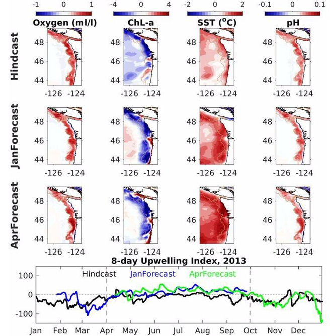
OA adaptation strategies for shellfish aquaculture in the Chesapeake Bay
This project produces a dashboard for Chesapeake Bay users to assist with adaptive strategies for ocean and coastal acidification.
OA adaptation strategies for shellfish aquaculture in the Chesapeake Bay Read More »